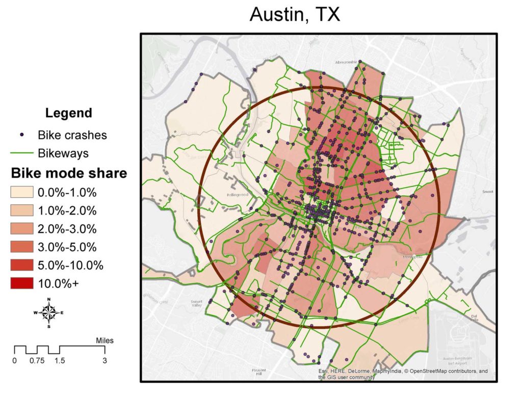
OSMnx makes it easy to generate statistics on street networks by city extent, or by polygon shape. Here are the stats for the study cities, clipping the bike network (including bike paths, excluding freeways) to the 5-mile circle:
| Austin | Charlotte | Columbus | Minneapolis | |
| Nodes (intersections) | 10470 | 5417 | 12208 | 17892 |
| Streets per node (avg) | 2.98 | 2.82 | 3.16 | 3.13 |
| Segment length (ft., avg) | 323 | 394 | 321 | 299 |
| Street segments, total | 17733 | 9291 | 20976 | 30909 |
| Bicycle mode share | 3.6% | 0.7% | 2.3% | 4.7% |
This covers the entire circle, not just the census tracts, so the area is identical for the four cities. Once again these aggregated stats show very strong correlations, especially between bike mode share and intersection density (r=0.91). The fact that there are three times as many intersections in Minneapolis’ central city than in Charlotte’s is a somewhat remarkable finding, though it’s consistent with the experience of riding around those cities. Higher intersection density means that there are more choices for people getting around the city, which in turn means that the arterials have less traffic on average, and there are more alternate routes for bikes.
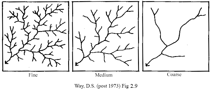
There’s an analogy to the geophysical concept of drainage density. A river network with fine drainage density (relatively small space between river channels) will drain very quickly during storm events because there are so many different ways for the water to reach a river channel. If you think about the networks below as representing the morning commute, the “coarse” network will require much larger, higher-speed roads than the “fine” network. And it’ll suck for bicycles.

One of the problems of cycling advocacy is that there’s often not much that can be done to change this indigenous condition. Charlotte is already built out with high-volume streets and long blocks, and at this point you can’t make its street network look like Minneapolis’ (or Copenhagen’s).


